The Katsina Ala (or Katsina-Ala) is a river in central Nigeria, located within the Middle Belt. It serves as a major tributary of the Benue River. The river originates in the Bamenda Highlands of northwestern Cameroon and flows approximately 320 kilometres (200 miles) northwest before crossing into Nigeria, ultimately joining the Benue River.
Geographical and Environmental Overview
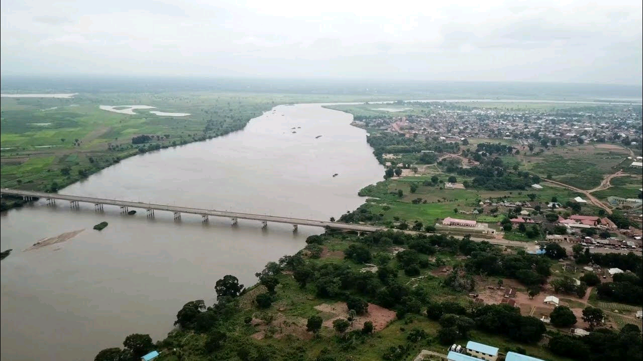
The Katsina Ala River flows primarily through Benue State, Nigeria. The Katsina Ala community, situated along the river, covers an area of 2,402 km² and had a population of about 224,718 according to the 2006 national census.
This river is part of environmentally sensitive regions in Benue State, vulnerable to the impacts of climate change, including:
- Decreased rainfall
- Drying of rivers and surface water bodies
- Flooding
- Erosion
- Pest and disease infestation
- Land degradation
Location
The Katsina Ala River is found mainly in Benue State, after crossing the Nigeria–Cameroon border, and drains into the Benue River.
- Longitude: 9° 15′ to 9° 56′ East
- Latitude: 6° 55′ to 7° 36′ North
Towns
- Katsina-Ala is the capital and major town of the Katsina Ala Local Government Area, Benue State, Nigeria.
- The town is located along the course of the Katsina Ala River.
- It features numerous hamlets and villages along its route.
- The town hosts a central market every Thursday.
Pollution
The Katsina Ala River is slightly polluted, particularly due to:
- Heavy metal content from abattoir effluents, which disrupt the river’s physicochemical balance.
- Risks of bioaccumulation and biomagnification of toxic metals through prolonged human use.
Recommendations:
- Effluents from abattoirs should be treated before discharge into the river to mitigate environmental and public health risks.
References
Sources include environmental studies, regional hydrological surveys, and Nigerian census data. Detailed references should be consulted for in-depth environmental analysis and policy frameworks.